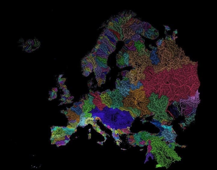
The map above shows the approximately 8,000 catchment areas of Europe’s 1.2 million streams and rivers. The map was created by Robert Szucs (reddit user Fejetlenfej), who runs GrasshopperGeography.
He explains that the map was made using:
…mostly with the open-source QGIS software. Data: European Environment Agency (EEA). 2012. EEA Catchments and Rivers Network System (ECRINS).
High resolution map of Europe’s 1.2 million streams and rivers in beautiful rainbow colours, divided into almost 8000 catchment areas. It shows Strahler Stream Order Classification. The higher the stream order, the thicker the line. I really like this map.
The 10 longest rivers in Europe are:
- Volga – 3,692km
- Danube – 2,860km
- Ural – 2,428km
- Dnieper – 2,290km
- Don – 1,950km
- Pechora – 1,809km
- Kama – 1,805km
- Northern Dvina–Vychegda – 1,774km
- Oka – 1,500km
- Belaya – 1,430km
If you think the map is cool, you can buy a print on Etsy here and visit his Etsy shop to see other similar prints.
If you enjoyed this map, please share it with a friend:
Leave a Reply